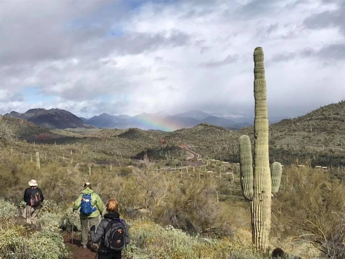
The PebbleCreek Hiking Club has been established to provide PebbleCreek residents with the opportunity to enjoy recreational hiking in an organized, safe and social environment. Safety is a key concern. Hikers are accompanied by a leader and sweep carrying an emergency locator beacon , medical kit and walkie talkies. The regular hiking season is the third week of Sept. to the first week of May. During the summer, there are B/C+ hikes held Monday, Wednesday, Friday and Saturday and D/D+ hikes held Tuesday and Thursday. During the regular season the schedules is as follows:
D hikes (3.7-5.0 miles) are held on Tuesdays and Thursdays
C hikes (6.0-8.0 miles ) are held Mondays, Wednesdays, Fridays and Saturdays.
B hikes (up to 12 miles) are held Mondays, Wednesdays,Thursdays, Fridays, and Saturdays
A hikes (up to 16 miles) are held on Mondays
For PROSPECTIVE members
Prospective members must independently walk around Robson Circle twice and complete an Intro hike. Once completed, new members need to submit their registration form and dues.
Hikers are reminded that participation on these hikes is a reaffirmation of the waiver they signed when they joined the club. The waiver may be found here.
The next hiking club meeting is scheduled for Thursday, September 15th at 7PM in the Tuscany Falls Ballroom
MEMBERSHIP for the 2021/2022 Year
Membership dues are $10.00 per member. Each member must submit a new registration form along with their dues payment. This is an annual requirement. Checks should be made payable to: PCHC. Dues may be paid at the club's monthly meetings. They also may be sent to: Ron Hoffman, PCHC Treasurer, 3315 N. 147th Lane, Goodyear, AZ 85395.
Patches and Pins
If you would like to order an Awards patch for the number of hikes or miles achieved, click on the Patches and Pins above. If you would like to order a Pebblecreek Hiking Club Nametag, click on the Patches and Pins
President Neal Wring PCHCP@gmail.com
VP Nancy Love PCHCVP@gmail.com
Treasurer Ron Hoffman PCHCTreas@gmail.com
Secretary Laurie Rosenbloom PCHCSecr@gmail.com
SMUGMUG: To see pictures of our various hikes around Phoenix and beyond, visit SmugMug. See a Club Officer to get the secret password. https://pchikingclub.smugmug.com
MILEAGE STATS To see your mileage stats. please click the button MILEAGE STATS
Hikes depart Eagle's Nest parking lot at 6:00am. Bring plenty of water and electrolytes.
Weekly Hikes for July 4, -- July 9, 2022
Monday, July 4, 2022 – Verrado –Deadhead Pass Loop, (Exploratory). Rating B. Bill Halte will lead this exploratory 10-mile hike with around 800 feet of elevation. We'll be hiking the newest trails out by Deadhead Pass. No park fees. Restrooms are at the trailhead. Driving distance is 18 miles RT. Suggested driver donation $3.00.
Directions to Meck Park (21098 W. Highlands Park Drive) -
Head north on PebbleCreek Parkway to Indian School Road. Go west (left) on Indian School Road. Turn right on N. Verrado Way. Left on N. Highlands Park Drive, and the first right is Meck Park.
Monday, 7/4/2022. Coyote Den & Painted Desert Star Tower, Rating D Dennis Zigmunt will lead. This is a 4.5-mile hike from the Star Tower area in Estrella Ranch to the Coyote Den break area near Cotton Road. This hike follows most of the perimeter trails around the area, and it includes a trip up or down the Painted Desert trail which has an interesting collection of painted rocks. Good single-track trails for the most part, with some rocky sections. The Painted Desert trail has a steep climb or descent to about 50’. Elevation gain 530’ on good trails thru rolling hills. This is an area of trails on the west side of Estrella Parkway. Restroom in the parking lot. Driving distance is 18 miles RT. Suggested driver donation $3.00.
Directions to Star Tower Parking.
Go south on Pebble Creek Pkwy and Estrella Parkway to a driveway just past the Star Tower (a rusty steel and rock tower on the west side of Estrella Parkway.
Tuesday, 7/5/22. Maricopa/Estrella Foothills (SR/PA) from EMRP boundary to Estrella Foothills HS parking lot. Rating D Challenge (miles). Dennis Zigmunt will lead. 6 miles and 185 ft elev. Trail follows the Park Ave Trail to power lines (SR Trail) to parking lot. Crosscut Trail from Park boundary to Pederson Trail. Driving distance is 18 miles RT. Suggested driver donation $3.00.
Directions for Estrella Foothills.
Take Pebble Creek and Estrella Parkways South to Estrella Foothills High School turn left at high school, then left into parking lot.
Wednesday, July 6, 2022-- Toothaker, Gadsden, Coldwater. (Estrella Mountain Regional Park) Rating C. Eileen Mosse will lead. Approximately 7.4-mile hike, with an elevation gain of 700 feet. Take Toothaker until it ends, turn left on Gadsden, then turn left to return on Coldwater. The trail is relatively flat, with long views of the Estrella Mountains and valley to the east and west. There are foothills to the left and larger mountains to the right as you travel east on the Gadsden Trail. Trail condition--good hiking trail; most of the trail is part of the Maricopa Trail System. A bathroom is located at trailhead. Park fee is $7.00 per car or use Maricopa County Park pass. The driving distance is 20 miles roundtrip. Suggested driver donation is $3.00.
http://pchikingclub.smugmug.com/EstrellaMountainRegionalPark/Toothaker,Gasden,Coldwater.
Directions to Estrella Mountain Regional Park--
Toothaker Trailhead--Drive south on PebbleCreek/Estrella Parkway. Turn east (left) onto Vineyard Avenue just across the Gila River. Turn right into Estrella Mountain Park and pay park fee. Continue driving and park at the Rodeo grounds.
Thursday, July 7, 2022 -- Wild Burro/Pipeline trails to floating Bridge (Lake Pleasant Regional Park). Rating D. Dennis Zigmunt will lead. This is 4.4 mile in and out hike with an elevation gain of 500 ft. The hike starts out at the Twisted Talon parking area and goes north to a floating bridge. The Wild Burro trail goes along the lake around a small cove before rising up to the Pipeline Trailhead and then on to an unusual floating bridge. There is a good chance to see wild burros on this trail. Restrooms and water are at the trailhead. Park fee is $7.00. Driving distance RT is 80 miles. Suggested driver donation is $8.00.
Directions to Lake Pleasant:
North on 303 to Lake Pleasant Road. Turn left (north) on Lake Pleasant Road to Arizona 74. Turn left (west) and continue to Castle Hot Springs Road and turn right (North). Go 2.1 miles and turn right onto Lake Pleasant Access Road. Pay $7.00 park fee then turn right on South Park Road. Turn left on Desert Tortoise Road and drive about .25 miles. Trailhead is on the left.
Friday, July 8, 2022 – Thunderbird Park –Cholla /Arrowhead /Coachwhip – Rating C. Eileen Lords Mosse will lead. Thunderbird Park offers 1,185 acres of mountain preserves and approximately 20 miles of hiking trails. This hike covers 5.5 miles with an accumulated elev. gain of 1020 ft. We will be hiking 2 small peaks via the trails of Cholla, Arrowhead Point, and Coach Whip. This is a fairly well trafficked area with frequent urban views. Trails are well marked but rocky. Restrooms are at the TH. No park fee. Driving distance RT is 60 miles. Suggested driver donation is $6.00.
Directions to Thunderbird Park
Take 101 North.
Turn left (north) on 59th Ave.
Turn Left into parking lot of Thunderbird Park.
Saturday, July 9, 2022 – Ford Canyon to the dam (White Tank Mountains). Rating C. Eileen Mosse will lead. The hike is 7.5 miles out & back on the same trail with an elevation gain of about 1100 ft. Rocky scenic hike along the side of the canyon to large boulders and dam in the wash. Trail continues but is not maintained beyond our stop point. Some may want to venture further during the snack break/turnaround point. About half the hike is an average trail with the middle part being steep and rocky to the dam. There are restrooms at trailhead. Park fee is $7.00 per vehicle. Driving distance is 30 miles RT. Suggested driver donation is $3.00.
http://pchikingclub.smugmug.com/WhiteTankMountainRegionalPark/Ford-CanyonMesquite
Directions to White Tank Mountains Regional Park
Take 303 North (right).
Exit at Northern (next to zoo) and turn left (West).
Turn right on Cotton.
Turn left on Olive and follow it to the park gate.
Ford Canyon Trail trailhead parking is at Picnic area #7. Take the Waddell Trail
across to the Ford Canyon Trail.
Would you like to join the PC Hikers? Complete the above form so we can set up an Intro hike with you. Then see the Documents Page for registration and waiver forms. Do you have questions? Ask them in the above section and we will get back to you.
Pebblecreek Hiking Club
Copyright © 2018 trails - All Rights Reserved.
Powered by GoDaddy